India’s Monsoon Progress Stalls Amid Heatwave and Atmospheric Shifts
The southwest monsoon has experienced a significant deceleration across India following a rapid start to the season. While the weather system initially advanced through 19 states in 15 days, movement has remained stagnant over Telangana since June 8, delaying critical rainfall for large portions of north and central India.
Key Takeaways
- The monsoon has stalled over Telangana since June 8, halting its expected progression into north and central regions.
- Five simultaneous atmospheric systems, including weakened Arabian Sea currents, are hindering the seasonal advancement.
- Several regions, including Uttar Pradesh and Maharashtra, face continued heatwave conditions with temperatures consistently surpassing 40°C.
- The India Meteorological Department (IMD) projects that conditions will become favorable for monsoon advancement within the next 4 to 5 days.
Why has the monsoon slowed down?
Meteorologists have identified a convergence of five distinct atmospheric systems currently disrupting the steady northern advancement of moisture-bearing winds. The seasonal progression has faced headwinds due to diminished moisture transport from the Arabian Sea, coupled with an inadequate northward shift of cloud formations from southern regions.
The Intertropical Convergence Zone (ITCZ), a critical driver of the monsoon, has failed to strengthen adequately by mid-June. This failure to migrate northward has prevented the effective channeling of moisture into the Indian subcontinent. Additionally, the positioning of upper-atmospheric jet streams—fast-moving air currents situated between 8 to 15 kilometres above the surface—is actively impeding the movement of monsoon clouds. These variables, combined with developing El Niño-like conditions, have effectively throttled the velocity of the monsoon’s expansion.
Seven states continue to experience intense heat
The stagnation of the monsoon has left large swathes of the country vulnerable to extreme thermal conditions. Many cities located in Madhya Pradesh, Uttar Pradesh, Bihar, Jharkhand, Rajasthan, Maharashtra, and Odisha have recorded daily maximum temperatures exceeding 40°C.
Banda, located in Uttar Pradesh, has emerged as the hottest region in the country, reaching a peak temperature of 43.2°C. Other regions facing severe heat include Brahmapuri in Maharashtra at 42.3°C, Boudh in Odisha at 42.8°C, and Daltonganj in Jharkhand at 42°C. Furthermore, Bilaspur in Chhattisgarh recorded 41.6°C, Chapra in Bihar hit 41.6°C, and Khajuraho in Madhya Pradesh saw temperatures reach 41.4°C.
El Niño-like conditions may affect rainfall pattern
A satellite-based assessment conducted by the US National Oceanic and Atmospheric Administration (NOAA) indicates that the Intertropical Convergence Zone (ITCZ) has not attained the necessary strength to drive rainfall inland. This lack of intensity is a primary factor in the current monsoon slowdown.
Emerging El Niño-like conditions are further complicating the seasonal outlook, as these patterns are historically associated with prolonged dry spells and irregular rainfall distribution. While satellite data currently confirms active thunderstorms over eastern regions of India, cloud density remains significantly low over Gujarat, Rajasthan, Madhya Pradesh, and other parts of western India, suggesting that the moisture deficit in these zones may persist.
Rain forecast for June 20 and June 21
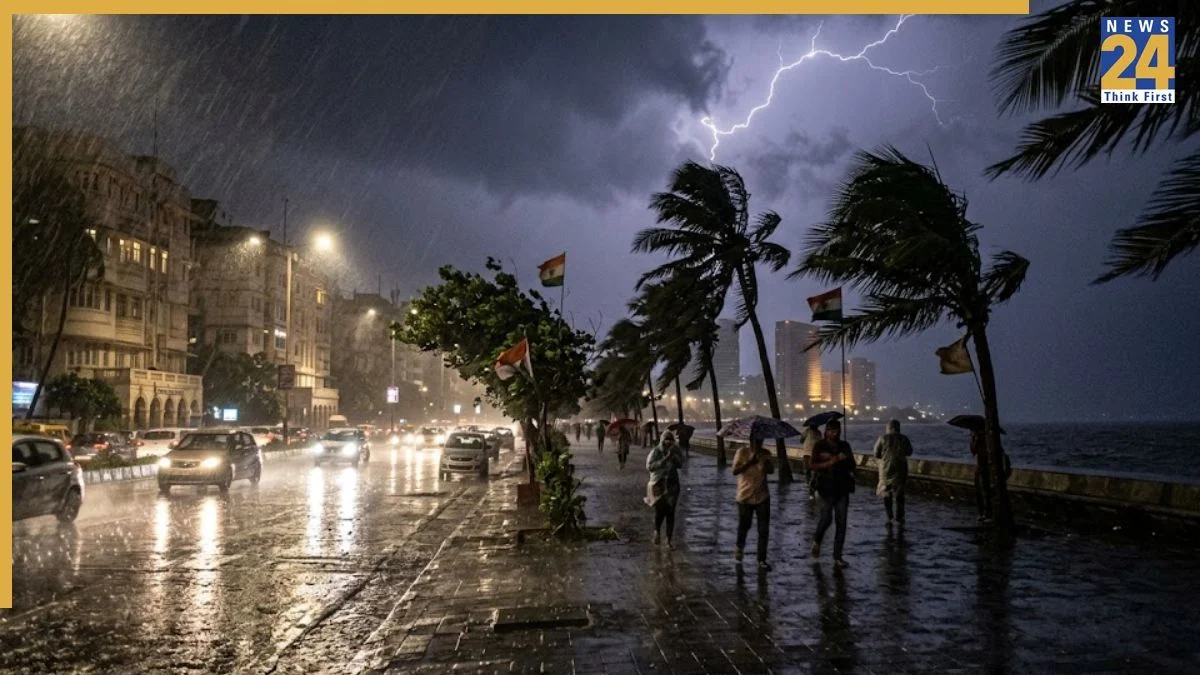
Meteorological models predict an uptick in rain activity across various regions on June 20 and June 21. States including Bihar, Jharkhand, Odisha, West Bengal, and Sikkim are anticipated to receive rainfall, with Bihar potentially facing strong winds reaching 50-70 kmph.
Heavy rainfall is expected to impact Assam, Meghalaya, Arunachal Pradesh, Tamil Nadu, Puducherry, and portions of Karnataka. Thunderstorms coupled with gusty winds are also likely in Rajasthan, Madhya Pradesh, Chhattisgarh, and the Vidarbha region. On June 21, heavy rain is projected for Sikkim, north Bengal, Assam, and Meghalaya. Thunderstorms with wind speeds between 40-60 kmph are forecasted for Rajasthan and Madhya Pradesh, while Jharkhand, Odisha, West Bengal, Tamil Nadu, Puducherry, Karnataka, and Maharashtra will likely continue to experience periodic showers.
When will the monsoon advance again?
The India Meteorological Department (IMD) indicates that a potential weakening of the current jet stream pattern could assist the monsoon in regaining its momentum. Environmental conditions are projected to turn more favorable over the next 4 to 5 days.
This shift is expected to facilitate the southwest monsoon’s advance into Maharashtra, Karnataka, Chhattisgarh, and neighboring territories. Jet streams, defined as fast-moving air currents located approximately 8 to 15 kilometres above the Earth’s surface, play a vital role in regulating these moisture-laden clouds. Once these currents stabilize, the monsoon is expected to resume its regular trajectory northward, bringing relief to the regions currently experiencing heatwave-like conditions.
Future Outlook and Meteorological Context
The current monsoon pause highlights the sensitivity of India’s agricultural sector to atmospheric volatility. Historically, the Indian monsoon is characterized by periodic fluctuations; however, the emergence of El Niño-like conditions in recent years has introduced increased uncertainty into seasonal forecasting. The Intertropical Convergence Zone (ITCZ) remains the primary engine for this moisture transport.
As climate patterns shift, atmospheric experts are placing greater emphasis on satellite-based real-time monitoring to predict these stalled intervals. Future projections suggest that while the monsoon remains a robust system, the timing of its arrival and withdrawal may become less predictable, necessitating adaptive irrigation and water management strategies for farmers in north and central India. The coming 4 to 5 days will be critical for determining whether the monsoon stabilizes or continues to exhibit erratic behavior through the remainder of the season.
FAQs
Why has the monsoon stalled over India?
The monsoon has stalled primarily due to the weakening of moisture-laden winds from the Arabian Sea and the failure of the Intertropical Convergence Zone (ITCZ) to shift northward as expected. These issues are compounded by upper-atmospheric jet stream patterns and emerging El Niño-like conditions.
Which states are currently experiencing the most intense heat?
Seven states are facing significant heatwave conditions with temperatures exceeding 40°C, including Uttar Pradesh, Maharashtra, Odisha, Jharkhand, Chhattisgarh, Bihar, and Madhya Pradesh. Specific cities like Banda and Boudh have recorded temperatures as high as 43.2°C and 42.8°C respectively.
When is the monsoon expected to resume its progress?
According to the India Meteorological Department (IMD), favorable conditions for the advancement of the monsoon are expected to develop over the next 4 to 5 days. This shift should allow the system to move into Maharashtra, Karnataka, Chhattisgarh, and other regions.
What impacts do jet streams have on the monsoon?
Jet streams are high-altitude air currents located 8 to 15 kilometres above the surface. They influence the movement of weather systems, including monsoon clouds. When their positioning is unfavorable, they can block or slow down the progression of monsoon currents, leading to delays in rainfall.